A Very Windy Day
The challenge today was wind and continual elevation increases. The day started breezy, then wind speeds rose to 30 mph, with gusts to 45+ mph. Due to the head and cross winds, I was driving between 40 and 50 mph, just to make progress. The proliferation of snow fences on the south side of I-80 show the prevailing winter wind direction.
By the time I got to WY-72, near Elk Mountain and a few miles east of Walcott, the predictions were for 65+ mph gusts. By that time, I saw a fifth wheel overturned along with its dually truck and I had my wheels blown sideways, setting off all sorts of alarms. I-80 was closed to vehicles like our RV: light weight, high profile. So, I got off the road about 1:30PM. The high wind advisory said the winds would diminish in early evening.

After 5 hours waiting, I finally got underway and got to the Rock Springs KOA, Rock Springs WY, at 9pm. I was wiped from keeping the Goose on the road all day. An unfunny day, even though I kept reminding myself to enjoy the journey.
Max elevation today was 8600 feet east of Laramie. Temperatures were cool all day, in the 50s. At some point today, my right rear brake light lost its lens, so I’ve ordered one to repair the damage. I had thought the high winds damaged the slide cover, but it deployed this night with no apparent loss of function.
Crossing Nebraska
Underway 0755CT. 82 degrees at 8am at the horse event center; no shade yesterday. Start elevation about 1400 feet, and rose all day quite steadily to 4200 feet by the time I arrived in Sidney NE. Steady southerly cross wind all day, sometimes veering to a straight head wind. The head wind made me slow significantly to preserve fuel mileage.
I crossed the Platte river several times, as I-80 makes its way along that valley. The Platte has several very wide areas and there’s lots of land with water sitting in fields.
I saw lots of sand mining operations. One company, Paulsen, has left cement mixer barrels all along the fields next to I-80.
At Kearney, all of I-80 passes under The Archway, a museum explaining the Great Platte River Road. Kearney claims to be the sand hill crane capital of the world.
At several places along the Platte watershed, cottonwood trees were sailing their cottony seed pods everywhere, making it look like mild snow. I saw a lot of red wing blackbirds and brown headed cow birds.
The temperature along the road rose steadily all day, topping at 105 degrees F. I kept an eye on engine temperature, but it never rose into dangerous levels.
Arrived at 1426MDT at the Cabela’s world headquarters in Sidney NE. Quite a nice full service RV park as a part of the store complex. First come, first served, and usually only about half full. Pull into any open site, then go into the store to pay. Outdoor temperature is quite hot, but should cool as the sun sets. Overnight a front passed through, with the wind rocking the Goose on its leveling struts.
First time in Nebraska
Start odo 31719, heading to Lancaster Event Ctr, 4100 N 84th St, Lincoln, NE 68507.
Drove north then west, avoiding Kansas City MO. Decided to drive a few mph slower to see if I could get the fuel mileage higher. Many more trees, fewer open fields, so what I saw yesterday was certainly due to farming. Northern MO is flat. As I drove west, I was surprised by how wet were the fields. Either there was a huge storm in the last few days, or this is by design. I saw lots of water diversion dams, lots of drainage ditches, and the land looked like river bottom land. I saw lots of starlings chase a white bird, then also saw a coyote amid the birds. Coyote must have been trying to catch birds. Also saw an Amish one-horse buggy.
US-36 W is the Chicago-Kansas City expressway. Passed the birthplaces of Walt Disney, Gen. John J Pershing and JC Penney. Chillicothe is the home of “Sliced Bread.”
Just east of St. Joseph, an 18-wheeler took a curve too fast and blocked the highway. My GPS showed roads where I could backtrack and avoid, so I started. The roads were gravel, connecting farmers and fields. After five miles of 20mph on those gravel roads, I got back to US-36w and proceeded. The ambulance passed me, so I guess I saved time. Of course, for the next couple of highway miles, my tires shed gravel and mud, slinging them gratuitously.
East of St Joseph, I crossed the Platte River. Not sure if this is the river of “westward ho!” fame, but it reinforces why I’m seeing bottom land and lots of water in the fields. Lots of levees.
Went north on I-29 just east of St Joseph. Crossed briefly into Iowa, crossing the Nishnabotna river, notable for its Indian name meaning “canoe making river.” Then Iowa 2 west across the Missouri river, climbing from the bottom land to the bluff on the Nebraska side.
Got near Lincoln and found a Whole Foods for supplies. On to the Lancaster Event Center, where I am surrounded by a thousand horse trailers. Some have storage on top for surrey racing carts. No shade, and the AC is having trouble cooling the RV. Hope it continues to work!
Today was 323 miles, and just under eight hours elapsed driving.
West of St. Louis in Columbia MO
Departed Calvert City KY about 0755CT, having dumped tanks. Avoided the super slab north through Illinois in favor of crossing into Missouri early. Drove past Paducah, nice rolling road. Got onto 62 West, saw lots of redwing blackbirds. Got to the town of Wickliff, from which views of the Ohio river can be seen at the end of every westward-facing street. Wickliff has a state park with Indian mounds.


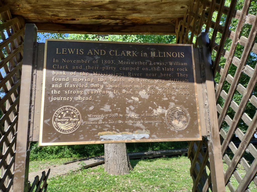
Crossed the Ohio river on an old scary, narrow truss bridge. Took it slow, as 18-wheelers were coming the other direction. My route is called the National Great River Road in Illinois. Low rice paddies with water being pumped into them from rivers and creeks. Passed through Cairo, IL, which is a dead river town. On the far side of Cairo, as part of a railroad overpass, there was a huge overhead levee gate that gets raised or lowered depending on river flooding. Continued sighting lots of redwing blackbirds, unsurprising since there is water and cat tails everywhere.
Crossed the Mississippi river from Illinois 146 west, across a modern cable suspension bridge. Much less scary than the bridge over the Ohio. Then got onto I-55 north, a straight shot in fantastic condition.
There were lots of billboards advertising Stone’s Sausage Shop in Perryville MO (city was established fairly early in 1831), so I stopped. They have 35 kinds of bratwurst, and I bought some bacon and original. Also bought cheddar horseradish cheese, some spicy beef jerky, best I’ve ever had. I bought Debbi a jar of pickled asparagus (ick!).
I continued up I-55, passing on both sides exposed sedimentary rock upthrust, probably part of the ancient inland sea. My route took me around the southwest of St. Louis, on which I crossed the Missouri river. Three rivers today! I’m a river-crossing animal!
West of Warrenton, the landscape changed. Much more open, fewer trees, lots more fields. Don’t know if this is climatological, or simply human activity (like farming).
There clearly is no prohibition on highway billboards along I-70 west. Large billboards are on both sides, each only about one-tenth of a mile apart. Reminds me of I-10 in south Mississippi, but the Missouri billboards don’t advertise casinos.
Arrived at Cottonwoods RV park about 3pmCT. My site has shade! A good thing in the 90 degree heat.
Second day underway, made it to western KY
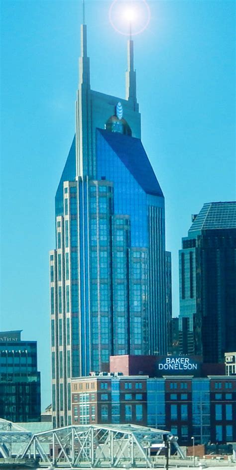
Start odo 31094. Easy access back to I-40, on which I continued past Nashville nearly to KY. There’s an interesting building on the Nashville skyline that looks like two statues of Meroni; turns out it is the BellSouth (now AT&T) building, sometimes called the Batman building.
Onto I-24, which was a nice road through sedimentary uplift. However, after one crosses into KY, I-24 becomes a shattered concrete road well past Fort Campbell, at which time it becomes merely a bad road.
I found that the larger tires I installed after my last trip make the speedometer read about 3 mpg low, as confirmed by two separate GPS systems. I guess that means “low and slow” is a little faster progress than I thought!
The vegetation I saw all day was typical east coast: sweet gum, oak, maple trees; lots of green brush; well-watered. It will be interesting to note when all that changes.
Lots of very large farms appear in western KY. Barley/ wheat/ corn, separated by trees and lines of green veg. Not yet into the waving wheat fields of the mid-West, but much more open than Maryland farms.
I figured out how to operate the HD radio in the Goose, but there was a paucity of entertainment (clearly, I’m picky).
The shift from Eastern to Central time caught me by surprise, and I arrived at the KOA in Calvert City KY at about 1:30pmCT. Lots of time to kill. I thought about extending my driving time on subsequent days, but just over 300 miles per day seems right now. Perhaps when I get to the “big empty” (thanks, Fred, for that image), I’ll prefer longer days.
The KOA is very nice. Clear roads, with a big topographical dip in the middle of the campground. Sites had been carefully leveled and all utilities worked well. There’s a power switch in the power pedestal for the cable TV amplifier, which I turned off as part of hooking up (I always turn off all breakers before plugging in). Of course, no cable TV until a helpful staff member pointed out my error!
On the road cross-country to The Dalles
Departed CFO about 0945. Positioning the Goose at the Gosling’s coupler took just one try, but lots of creep backwards/ cut the wheel/ creep backwards and so on. Rear end of Goose didn’t drop much when I put the Gosling’s weight on the hitch. When I went to hook up the trailer safety chains, I couldn’t get them into the hitch. I went looking for screw loops, found them in the wrong place in the garage, then attached them. Then I tried the safety chains in a different orientation and they worked!
Forgot my wallet, so made the gravel loop and stopped at the house again to retrieve. While I woke about 0730, it took two hours to get a shower and load the last of the stuff into the Goose. Part of that was Deb’s sewing machine and other stuff, plus a laundry-basket-full of spices and foodstuffs.
Took 64 West to Mocksville, where I fueled and bought a cranberry/ chicken salad sandwich for lunch. Phoned the KOA in Newport TN, but there’s some kind of festival and they were booked. Phoned Sherman Oaks and a very nice Cammie took my reservation, told me how to do self-check-in and asked that I text her the site I pick. $45, so not bad. Got on I-40 at Mocksville and continued past Asheville. The bridge reconstruction west of Asheville is complete, but I took it slow through all the curves.
Got to exit 435 at Newport and stopped for fuel and groceries (Murphy and Walmart). Once loaded, I proceeded to Sherman Oaks, which was as expected a second tier campground. However, the site is close to level and the utilities are fine. I’ll cook a burger for dinner and crash after I figure out all the stuff for tomorrow.
Incredibly windy all day long. TPMS worked great; rear tires significantly more load as shown by temperature and pressure. Don’t have TPMS on the trailer, so I looked out the side mirrors all day today to see if they were smoking or blown. Not, thank God.
Stupidities of today:
- Forgetting to put my wallet in my pocket.
- Driving all the way to TN with the hatches above the theater seats wide open. Only one thing fell, the jar of Valentina, and it didn’t bust.
- Forgot to pack the spare tire (rubber, not wheel) for the motorhome. Hope we don’t destroy a tire!
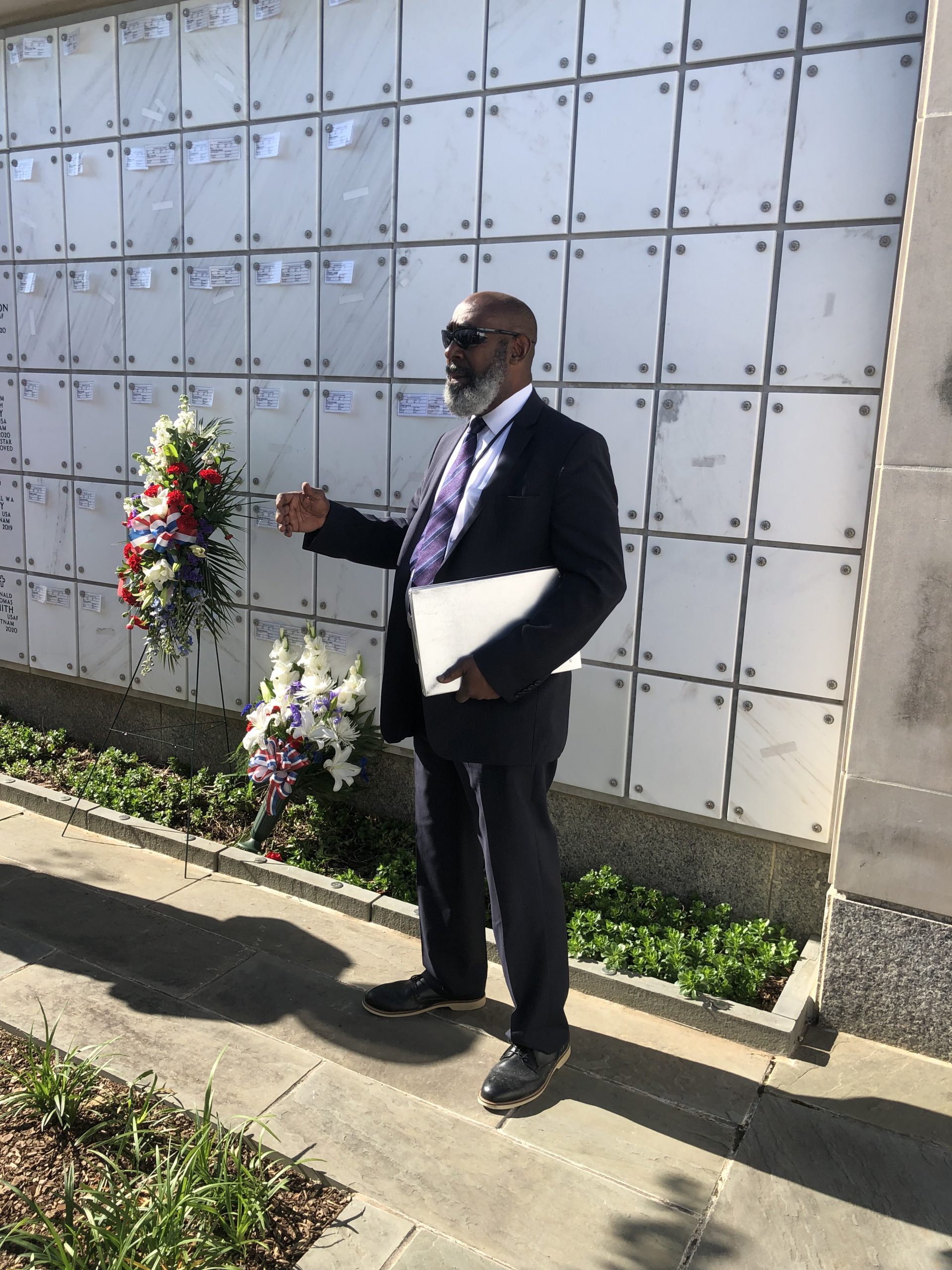
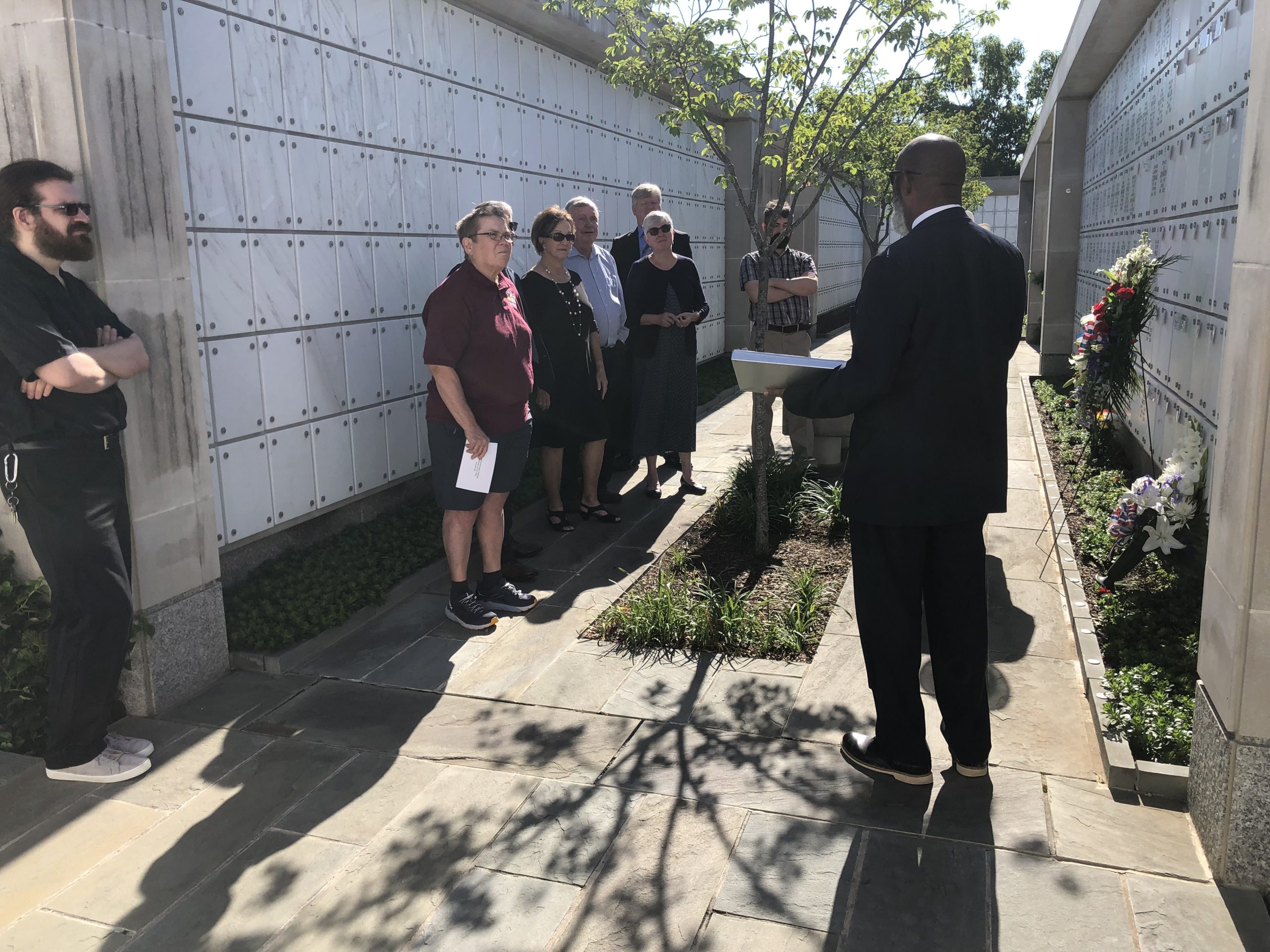
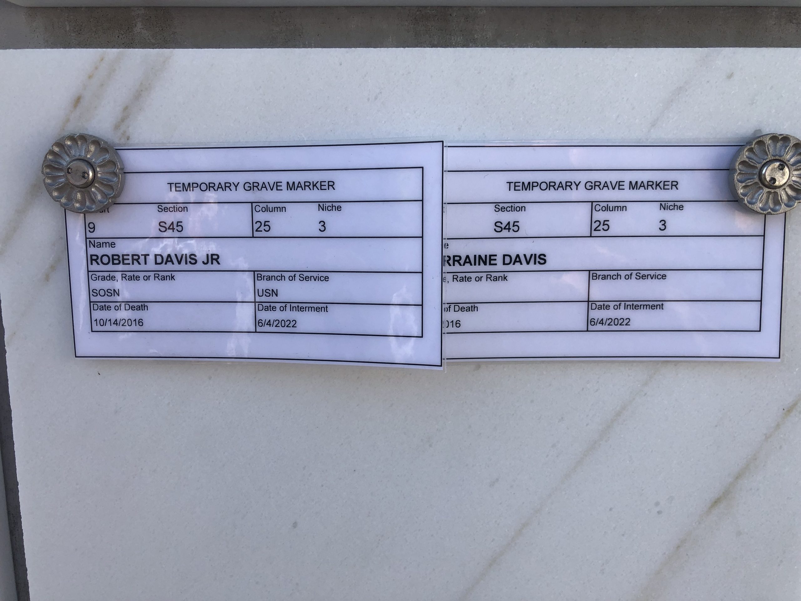
Bob and Lorraine at rest
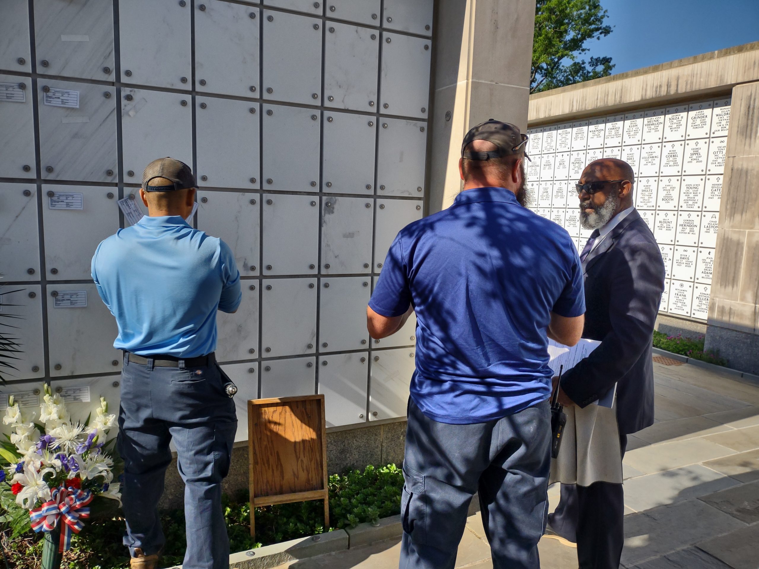
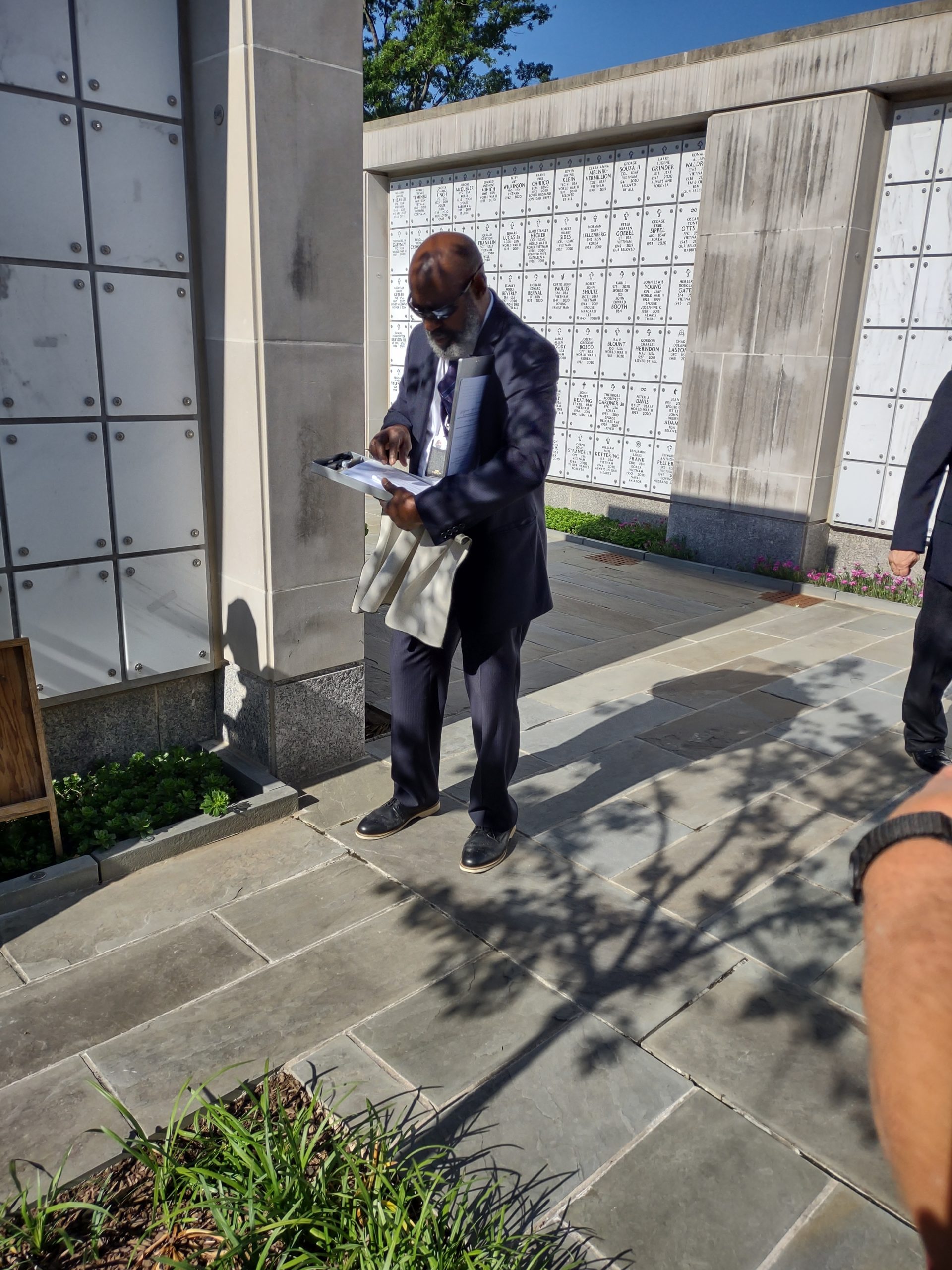
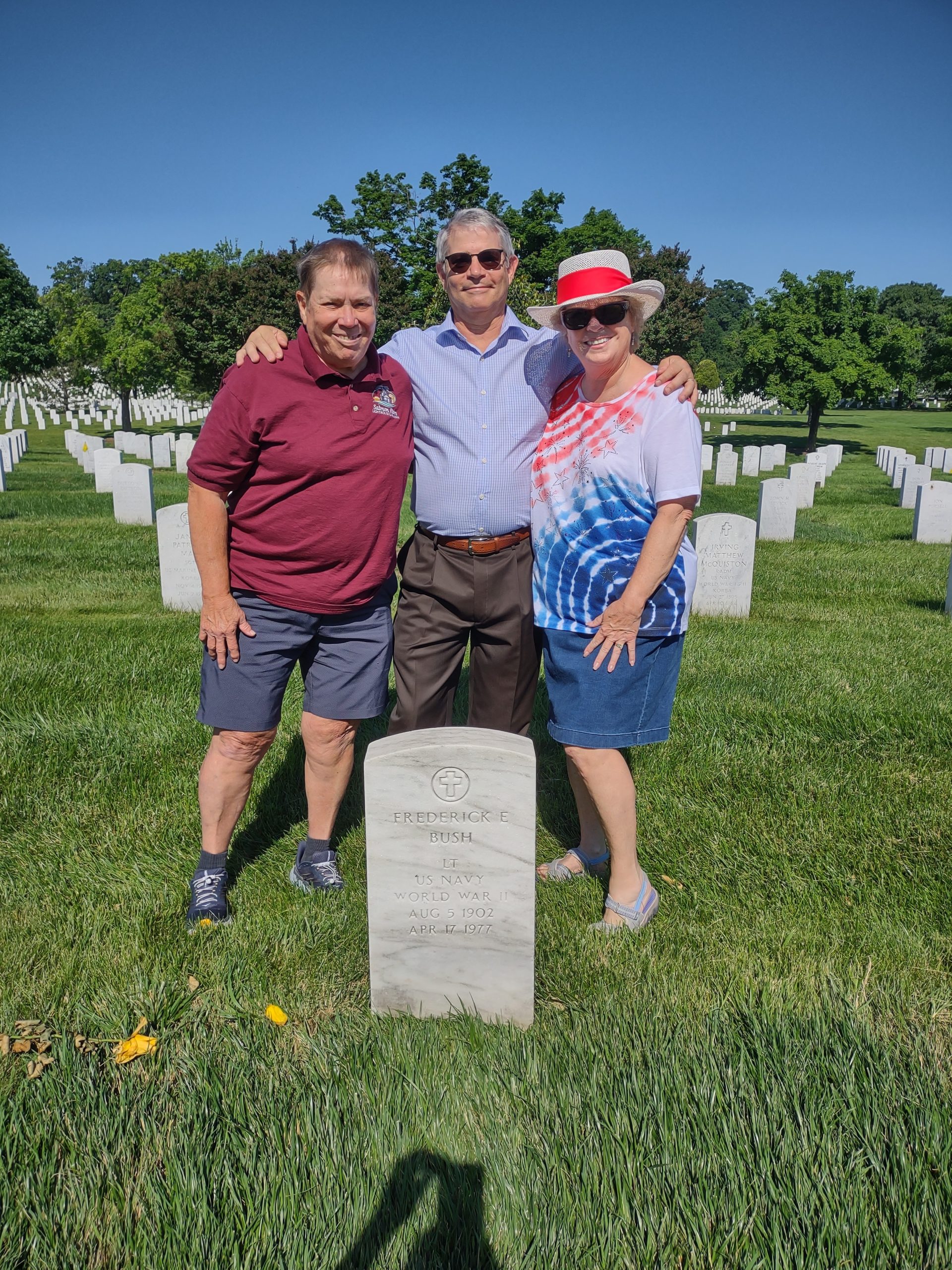
On June 4th, family and friends interred the earthly remains of Bob and Lorraine Davis at Arlington National Cemetery. Their ashes now rest in the columbarium. Our placement attendant, Bill, has been one of the people going into jungles in Papua New Guinea and Korea to recover remains and repatriate them. We were extremely glad to have Bill assist. There are temporary markers in place right now, but a permanent plaque should be there by the end of August. Attending were: Jim/ Deb/ Aaron/ Josh Davis; Mike/ Milly Boyt; Lorraine’s sisters Margaret Bush and Signe Ann Thrift; and Jim’s high school friends Steve Steele/ Bill Norris. We were accompanied in spirit and prayer by a host of family, friends and angels. Afterward, we visited the grave of Frederick Elijah Bush, a Pearl Harbor veteran and the father of the sisters.


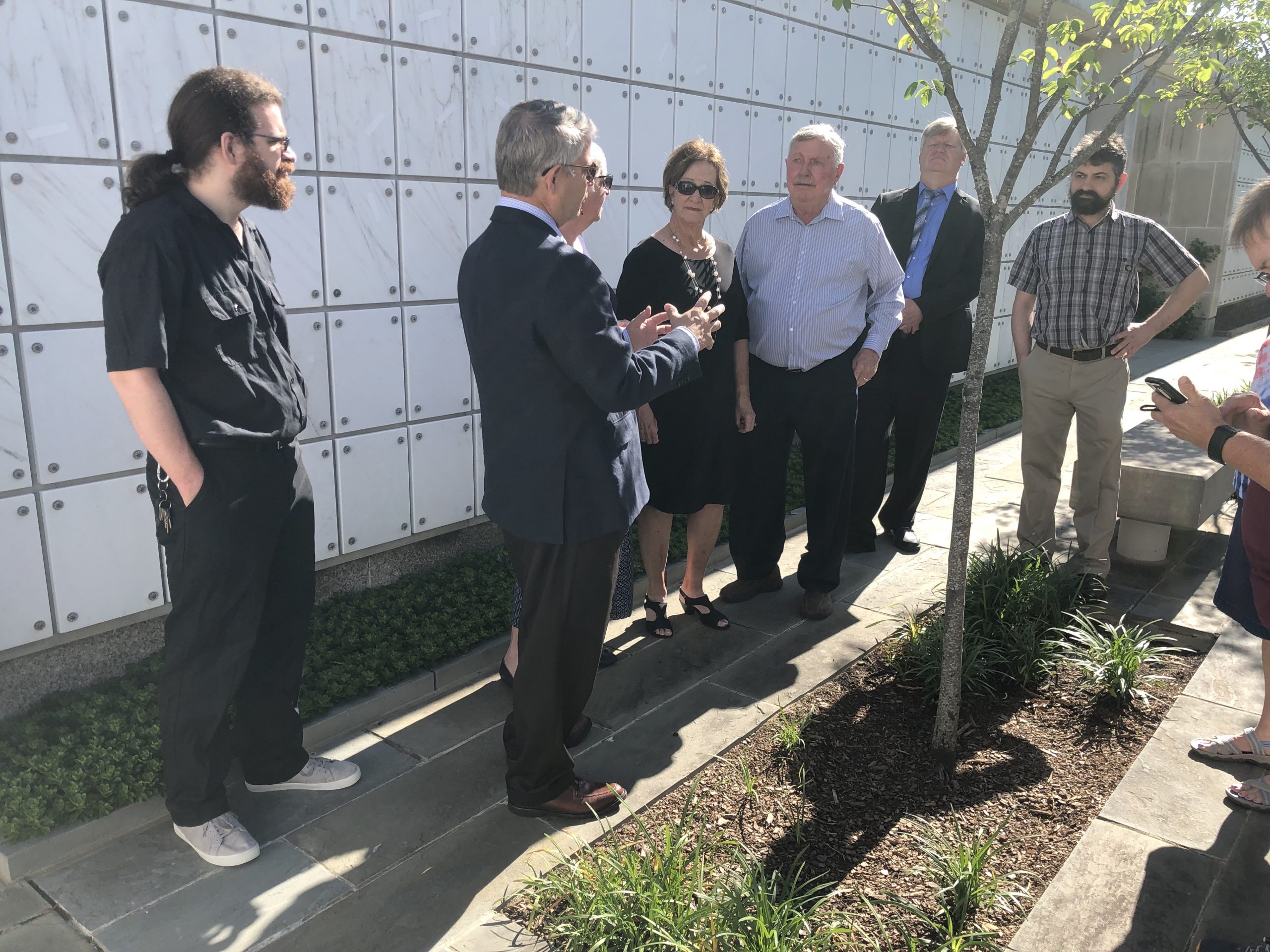


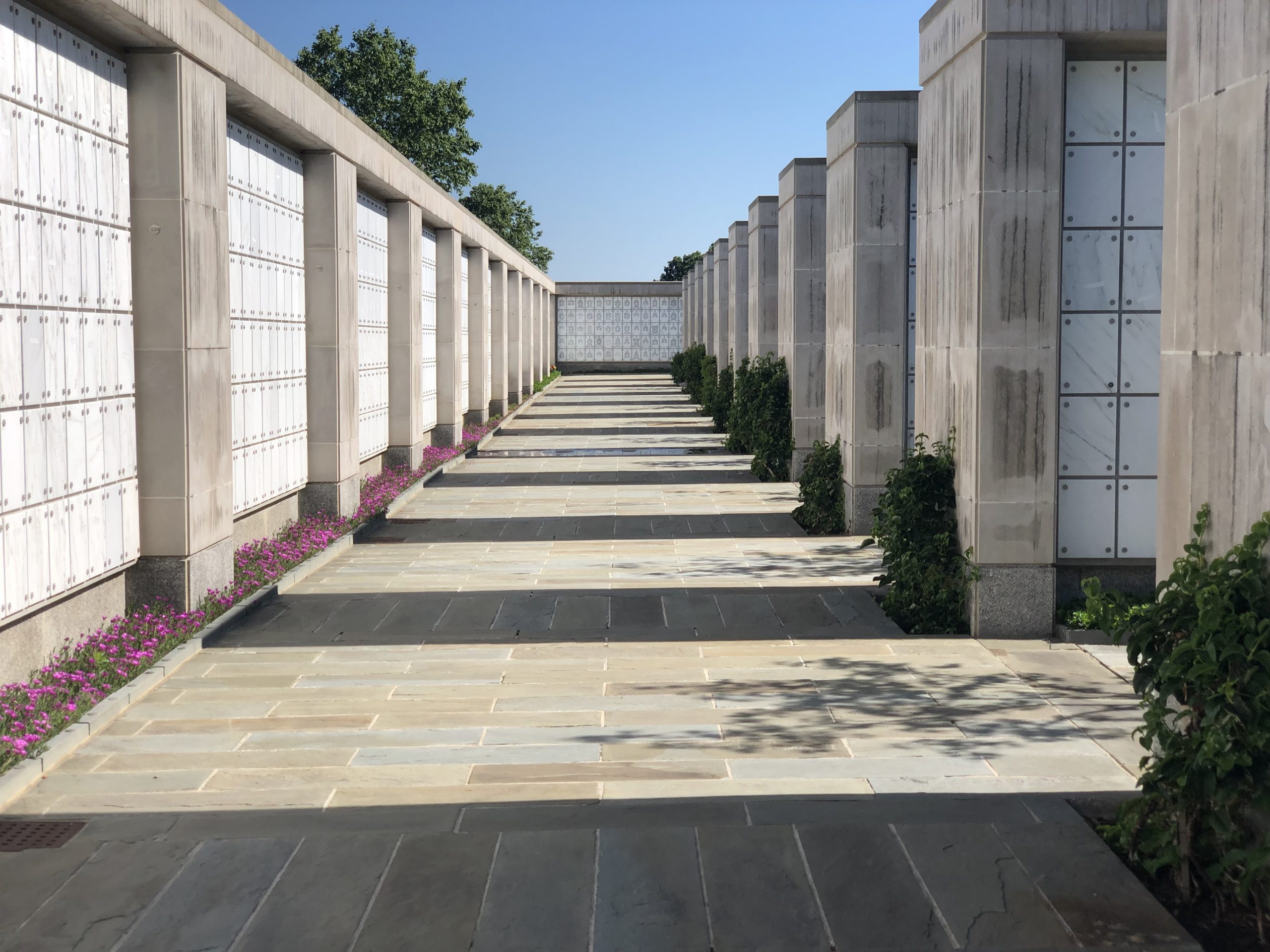
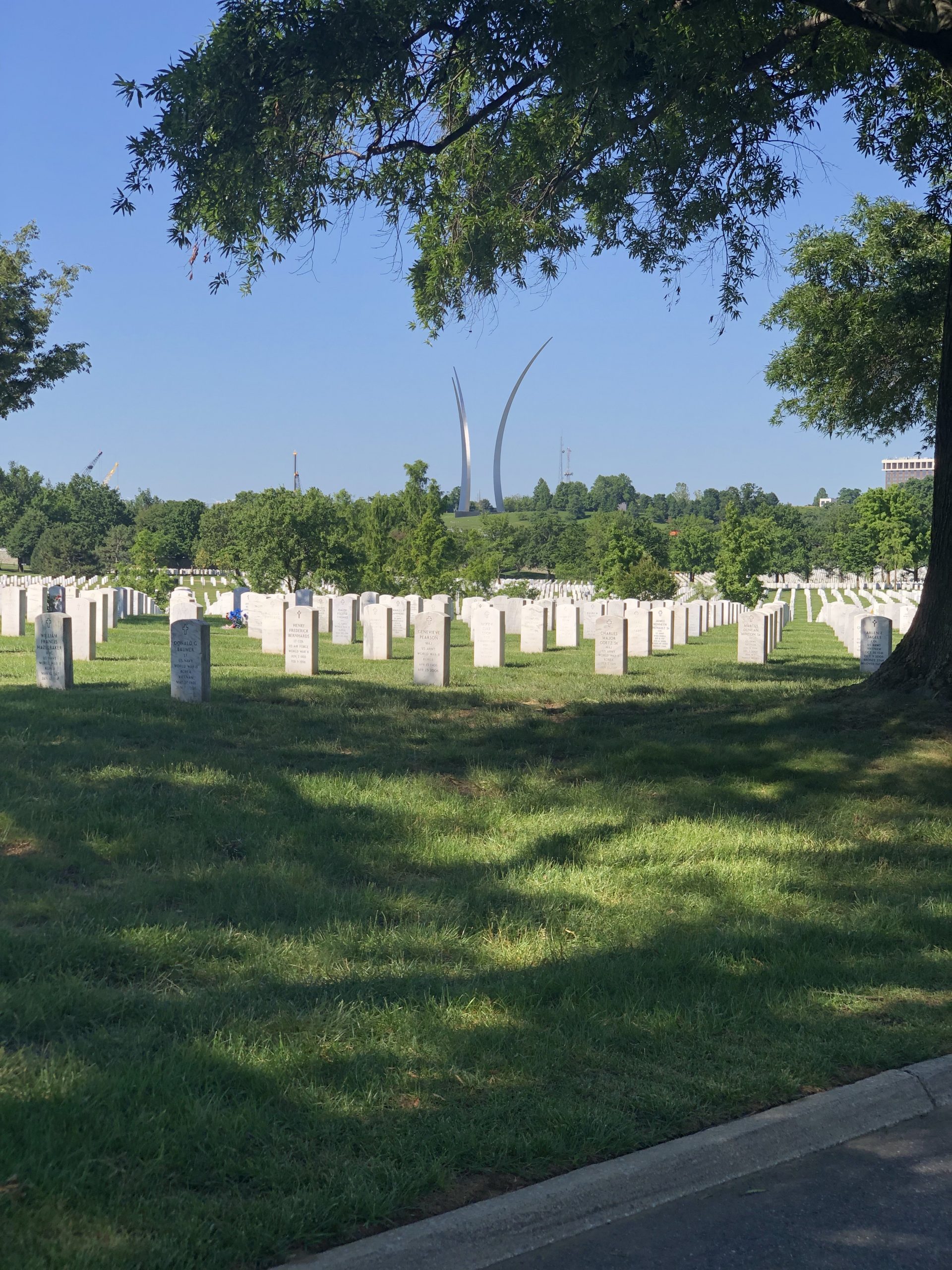

ANC is kind of the Davis family burying ground, along with Fort Lincoln cemetery in Brentwood MD and Greenwood Memorial Gardens in San Diego CA. There are about eight Davis family members at ANC, and it is the intention of Deb and Jim to join them when we inevitably pass.
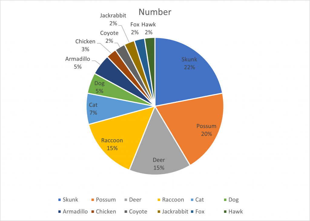
Roadkill analysis
We started keeping track of dead animals for our amusement on this trip. We only saw skunks in Texas; they haven’t gotten the word that stench does not overcome gross tonnage. Clearly, the chicken has things to teach the skunks and possums!
South of Chattanooga
Drove up and over Birmingham, past Huntsville, up to Chattanooga then down to Trenton GA. Lunch at Jefferson’s in Scottsboro, excellent food. Me a chicken avocado sandwich, Deb some shrimp tacos. We followed the Tennessee river valley, walled in by Appalachian mountains. Very pleasant.
The Lookout Mountain KOA is back in a hollow up a mountain. We realized when we got there that we’d lost two hours: one to switch to Daylight Savings Time, and one by driving from Central to Eastern time. We haven’t had watches on for a while.
Clean laundry room, so we caught up. Dinner from stores, then some work on laptops. Rain fell all night and the pitter-patter was soothing.
To Winfield for repairs
Drove to Winfield AL via Corinth MS (Thai lunch at Blazing Noodlez, an excellent meal), Tupelo, Guin and Gu-win. Found the Tiffin service center and chatted with the other Wayfarer owners here for work on their rigs.